
Quick note on Hurricane Laura and why it is heading toward the Louisiana/Texas border. Here is a look at the pressure map:

Check out the big orangish blob over the east coast and Florida. That’s the Bermuda High. The Bermuda High is a blocking mechanism. Storms can’t go through it. They have to go around it.
Normally the high sits in the Atlantic. If it far enough east, storms recurve and miss land. If it is in the western Atlantic, it forces storms onshore, usually to Florida. I don’t recall ever seeing the High cover all of Florida like this before (I’m sure it happens, but I’ve never noticed it in the midst of a major hurricane).
Two Implications
Two observations come out of this. First, the obvious which is Laura had no chance to hit Florida. It had to go into the Gulf. If you trace the bottom border of the High, you can see the furthest east it could go was New Orleans.
Second, and more unusual, is what happens after landfall. Recall, storms want to recurve unless they’re blocked by the High. Look at the forecast map.
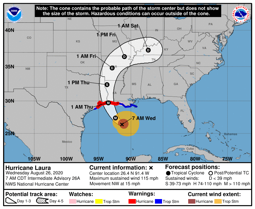
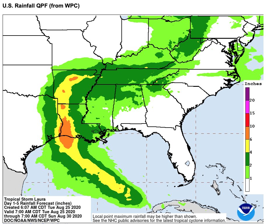
Once the storm passes that western edge of the High, it curves due east. This will bring several inches of rain as far east as possibly NYC. Memphis, Nashville, Pittsburgh, and others will experience heavy rain and possibly flooding.
This means Laura is basically two events. First, there is the traditional coastal wind and water damage. Then, there will be a multi state rain and flood event. There shouldn’t be the high inland winds like we saw back in Ike, but there will be some damage in addition to the coastal impact.
Keep An Eye on the High
With another month (or two?) of an active season to go, the location of the Bermuda High will play an important role in whether storms hit land or not. The High generally stayed west in 2005 which was a large part of what made that year so painful.